Garmin Oregon sat nav
- Last updated: 15/12/2016


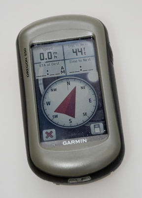
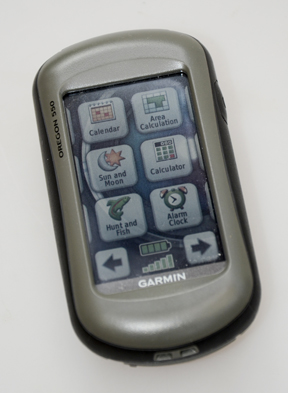
Turn on Garmin’s new Oregon 550 and all you need to know is displayed on the screen in an instant. A basic map of your location is backed up by a conventional looking compass complete with elevation, trip odometer plus sun rise and set. Add into this a camera; way point manager, route planner, track manager, area calculation, sun, moon and calendar information, alarm clock, the best times to go hunting and fishing, distance averaging and the facility to instruct the Oregon whether your on foot or using mechanical transportation. Add into this the facility to install detailed region specific combined 2 and 3D maps and you get a just a small idea of just what this multi-function satnav is actually capable of.
Tracker
Right, so why would a shooter need such a device? Turn on the Oregon and ask it to keep a track of your movements which means it’ll instantly record every step of your stalk or route to the high seat or where you shot your deer deep in the woodlands or kudu in the featureless scrub of Africa. If a particularly fruitful high seat is in an area that’s new to you, take a quick picture with the inbuilt camera and touch the waypoint or track manager icons and both are instantaneous recorded allowing you to return to the exact same place time and time again. Not only that it’ll also tell you the distance, elevation, time and a whole other bunch of facts you weren’t aware of all of which are actually extremely useful.
Whilst the Oregon is fully conscious of where it is at all times, unlike many an early morning stalker, by installing one of the numerous detailed mapping cards, a 2D or 3D topographical view will spring into life that contain every geographical and physical aspect of the ground you’re traversing, and where you’re heading towards and the potential obstacles you would do well to avoid.
Alpine Test
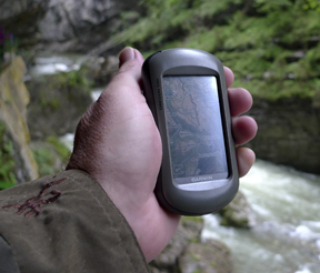
For this test the Oregon 550 was taken into the heart of the Bavarian Alps, the intricacy of which will defy all but the best satnav systems. Not so the Oregon, a circuitous walk along the length of the narrow, overhanging Breitachklamm valley failed to even ruffle the unit’s abilities whilst a circuitous journey down a twisting path was recorded with stunning, pin- point accuracy. Similarly, the fact it’s shockproof and waterproof meant brushing against rocks and heading beneath waterfalls wasn’t in the least detrimental to the unit’s physical well being.
Once you’ve returned to base you can then ask the Oregon to display your route, give it an exact name and once back home download the images, route and map details into your computer.
Compact
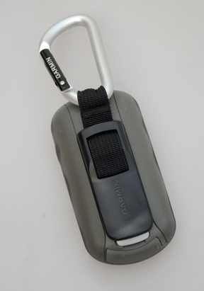
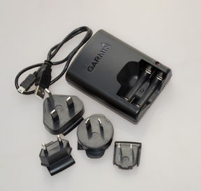
The Oregon 550 is the size of an average mobile telephone and has an easy to use and read touch screen. It draws its power from a pair of rechargeable AA batteries, comes complete with charger, plug adapters, USB cable and a sturdy karabiner belt clip.
Unfortunately, technology and ability such as this doesn’t come especially cheap, the Oregon 550 retailing for around £470 with the detailed mapping cards costing a further £169. What I will say is that although this Garmin might seem initially expensive, once you’ve got one you’ll find an ever increasing number of instances for which you’ll use it.
For more information on the Oregon 550 and the full range of Garmin satnavs visit www.garmin.co.uk or call 023 8052 4056.

click on image to enlarge

click on image to enlarge
click on image to enlarge
click on image to enlarge
click on image to enlarge
click on image to enlarge
click on image to enlarge


